Ancient Roads And Gradients
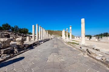
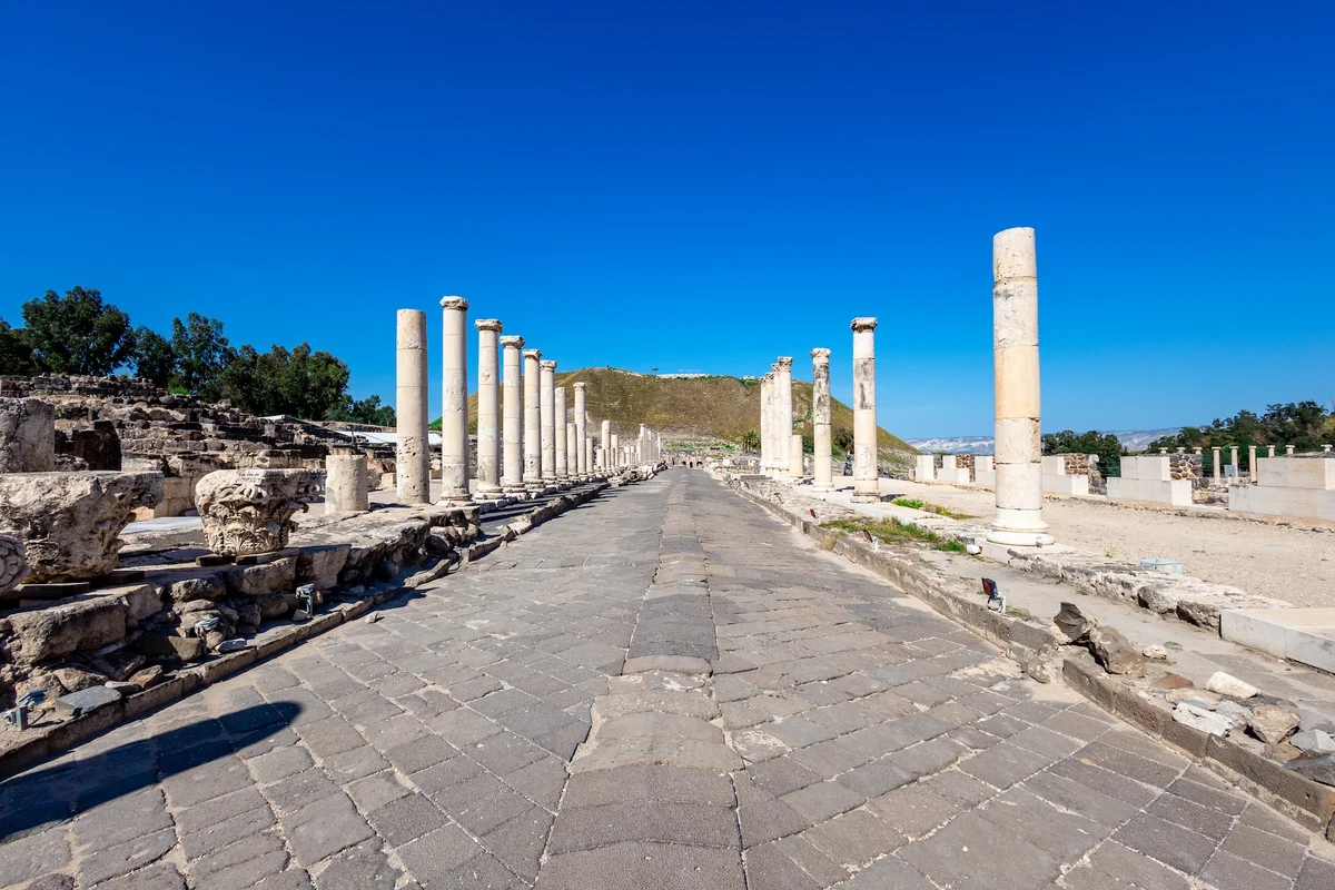
Ancient road builders rarely chased the straightest route; they chased the most walkable and drivable route for the animals and people doing the hauling. A road’s gradient—the change in elevation over distance—controls how much force is needed to move loads uphill and how much control is needed to prevent runaway motion downhill. Even when a route looks “direct” on a map, the ground profile often forces a sequence of climbs, flats, and controlled descents. Surviving alignments show repeated slope management rather than random wandering.
Gradient choices also interact with drainage. Water follows gravity, and a slope that is too gentle can encourage pooling, while a slope that is too steep can accelerate erosion and washouts. Builders had to balance these effects using local materials, roadbed thickness, and side ditches. In practice, the “best” gradient depended on soil type, rainfall patterns, and the availability of stone for surfacing.
One practical example: a cart loaded with grain can require much more traction on a modest incline than on level ground, and traction drops when the surface is wet or loose. Downhill, the limiting factor shifts from traction to braking control, which depends on surface friction and the ability to keep wheels from skidding. That difference alone pushes road designers toward grades that animals and drivers could manage repeatedly, day after day.
What People Get Wrong
A common misunderstanding treats ancient gradients as a pure geometry problem solved by surveying skill. In reality, the limiting constraints were mechanical and environmental: traction, wheel slip, erosion, and maintenance workload. A route that is shorter in plan view can become longer in travel time if it forces frequent steep sections that slow animals and increase damage to the road surface.
Another frequent error is assuming that “stone paving” automatically fixes gradient problems. A hard surface can reduce rutting, but it does not remove the physics of climbing force or downhill control. If the roadbed is compacted poorly or if water is not routed away, steep grades still generate higher shear stress on the surface and on the subgrade. That shear stress can loosen fines, widen ruts, and create channels that grow during storms.
Supporting technologies also matter. Ancient roads depended on drainage features such as side ditches and cross-drains, plus retaining works where cut-and-fill would otherwise collapse. Where those features were absent or poorly maintained, builders often reduced slope steepness to slow runoff and limit erosion. Even the choice of wheelbase and axle design for carts affects how easily a driver can control descent; narrow wheels can sink into soft ground, while wider wheels can spread load but may still slip on polished stone when wet.
Finally, people sometimes overfit modern expectations to ancient evidence. A surviving segment may represent only the portion that endured, not the original full profile. A road that was once graded more aggressively can look gentler after centuries of infill, erosion, and reconstruction. This is why interpreting gradients from partial remains requires caution and cross-checking with nearby sections.
How To Choose A Practical Grade
Read The Terrain, Not The Map
Start by extracting a ground profile along the road alignment using topographic data or field survey points. Look for repeated patterns: long gentle climbs, short steeper breaks, and flats where drainage can be managed. If you only compare straight-line distances between towns, you miss the constraint that builders had to work with ridgelines, valleys, and soil stability. A side observation from mapping workflows: when I used QGIS 3.34 in a similar terrain exercise, the “nice” route on a hillshade map still hid sharp local breaks in slope that mattered for traction.
When you evaluate a specific ancient segment, estimate the gradient over multiple window lengths, not just one point. A short steep spur can be tolerable if it is dry and surfaced, while a longer moderate grade can still be punishing because animals must sustain effort for longer. This is why road profiles often show stepwise design rather than one continuous slope.
Plan For Water And Erosion
Treat drainage as part of the gradient decision. A road that slopes enough to shed water can reduce pooling, but it also increases runoff velocity and erosion risk. Builders used side ditches, camber, and sometimes raised embankments to keep the road surface above the wettest zone. Where rainfall was seasonal and intense, a slightly gentler grade could reduce the speed of water and the formation of gullies.
In practical terms, you can look for signs of channelization: rills, sediment fans at the base of slopes, or repeated repairs along the same grade. Those patterns often indicate that the original slope exceeded what the local soil could tolerate under storm runoff. If you see frequent resurfacing evidence, the gradient may have been a compromise between travel time and maintenance burden.
Match Load, Traction, And Control
Gradient interacts with load and surface friction. Uphill, the required pulling force rises with both the weight of the load and the sine of the slope angle; downhill, the risk becomes wheel slip and loss of control. Ancient drivers used animals that could exert limited continuous force, and they also had to manage fatigue and injury. That pushes road design toward grades that allow repeated travel without forcing animals into near-maximal effort.
Surface condition changes the effective friction coefficient. Wet stone can become slick, loose gravel can shift, and compacted earth can behave differently after rain. A mild grade on a dry, compacted surface can be easier than a steeper grade on a wet, rutted surface. This is why ancient roads often show careful surfacing choices and why maintenance practices mattered as much as initial construction.
Expect Tradeoffs And Repairs
Ancient road building involved tradeoffs between earthworks, stone supply, and long-term upkeep. Cutting into a hillside can stabilize the roadbed but requires retaining structures and careful drainage. Filling a valley can create a stable platform but increases the risk of settlement and water infiltration. When repairs were frequent, the “effective gradient” for travelers could change over time as surfaces were re-laid and ditches were cleaned or neglected.
Realistic outcomes are usually incremental rather than dramatic. A modest reduction in grade can reduce slip events and slow erosion, but it does not eliminate damage during extreme storms. Builders likely accepted some maintenance cycles because the alternative—avoiding all steep grades—would have required far more earthworks or longer detours.
Case Examples From Evidence
Example 1: A Roman-Style Corridor Through Rolling Hills. An anonymized corridor in a Mediterranean-like climate shows a sequence of gentle climbs separated by short flats. The flats align with natural drainage lines and appear to have had side ditches that kept the roadbed drier. Where the corridor crosses a steeper spur, the road alignment shifts laterally to reduce the grade rather than cutting straight through. The pattern suggests that builders prioritized traction and drainage over strict geometric directness.
Example 2: A Pre-Road Track Up A Wet Valley Margin. A surviving track segment along a valley margin shows a grade that is less steep than the adjacent footpath. Local soil appears to be fine-grained and prone to rutting when saturated. The track’s alignment avoids the wettest swale and uses a slightly higher bench, which reduces the time spent in muddy conditions. In this scenario, the gradient choice likely served as a proxy for drainage management, not just for climbing effort.
Gradient Checklist And Comparison
| Decision Factor | Steeper Grade | Gentler Grade | What To Look For |
|---|---|---|---|
| Uphill effort | Higher pulling force; more fatigue | Lower sustained effort; steadier pace | Frequent slowdowns implied by repair density |
| Downhill control | Higher slip risk; harder braking | More stable descent; less skidding | Ruts and polished wear on steeper segments |
| Drainage behavior | Faster runoff; more erosion potential | Less runoff energy; less gully growth | Side ditch condition and sediment fans |
| Maintenance workload | More frequent repairs expected | Repairs still occur, often slower growth | Layering of resurfacing and patch boundaries |
Use this checklist when comparing two alignments. First, compare the length of the climb, not only the maximum slope. Second, check whether the roadbed sits above a wet swale or directly in it. Third, look for evidence of drainage features that match the grade, such as side ditches that remain aligned with the road. Fourth, treat surviving segments as partial records, since erosion and reconstruction can smooth the original profile.
Common Mistakes In Interpretation
One mistake is attributing every gentle slope to “advanced engineering.” Some gentle grades come from simple geography, such as following a ridge line that naturally rises slowly. Another mistake is treating a single measured gradient as representative of the whole route; ancient roads often used alternating segments with different construction methods.
People also overstate precision. Ancient builders worked with local instruments and practical experience, so grade control likely varied along a corridor. If you measure a modern elevation profile and compare it to a presumed original, you can misread the evidence because the road surface may have been raised, lowered, or buried. A mild frustration point: many public GIS elevation datasets smooth micro-topography, which can hide the very breaks that mattered for traction.
Finally, avoid promotional framing when discussing ancient roads. Claims that a road was “perfectly designed” for a specific animal or load lack direct evidence unless supported by inscriptions, construction records, or consistent archaeological measurements. A cautious approach compares multiple lines of evidence: alignment, drainage traces, resurfacing patterns, and the surrounding geology.
FAQ
What does “gradient” mean for roads?
Gradient describes how much elevation changes over a given horizontal distance. A higher gradient means a steeper climb or descent, which changes traction needs uphill and slip risk downhill.
Why do ancient roads avoid the steepest shortcut?
Steeper sections increase pulling force requirements for animals and increase downhill control problems. They also raise runoff energy, which can accelerate erosion and increase maintenance.
How can drainage change the “best” grade?
Water movement depends on slope and surface condition. A grade that sheds water can reduce pooling, but it can also speed runoff and create gullies if side drainage and roadbed structure are weak.
Can a paved road still fail on steep slopes?
Yes. Paving can reduce surface deformation, but it does not stop erosion of the subgrade or prevent wheel slip when wet. If drainage is poor, water can undermine the road and create ruts or channels.
How reliable are gradient estimates from ruins?
Estimates can be biased because erosion, infill, and later repairs alter the visible profile. Better reliability comes from measuring multiple segments and comparing them with consistent drainage and resurfacing evidence.
Author's Insight
Ancient road gradients reflect a mechanical compromise between traction, braking control, and water management. The same slope that helps drainage can worsen erosion, so builders needed drainage features that matched the grade. Archaeological remains rarely preserve the full original profile, which limits how precisely modern readers can reconstruct the intended gradient. A careful interpretation compares alignment geometry with signs of drainage and repeated maintenance rather than relying on one measurement.
Key Takeaways
- Gradient choices were driven by forces on animals and vehicles, not by map geometry alone.
- Drainage behavior and erosion risk change with slope, so side ditches and roadbed structure shaped “acceptable” grades.
- Surviving road segments can misrepresent the original profile due to burial, erosion, and resurfacing.
- Interpreting ancient gradients works best when you combine terrain profiles with evidence of drainage and repair patterns.